

Improving Goshawk Modeling With LiDAR
Coastal Goshawks are listed as Threatened in British Columbia. As such, species-habitat models currently exist that identify important Goshawk foraging and nesting habitat that might be affected by land-use management (e.g., forest harvesting). Current models are based on a data resolution of 100 square meters; however, significant areas of the coastal goshawk range have available full-feature LiDAR data acquired either by government of industry sources, which can detail forest structure at high resolutions below one square meter. Solstice explored these data for their potential in improving coastal goshawk habitat-predictive models, specifically in creating unbiased forest-structure measurements for features within the forest’s sub-canopy and enabling habitat predictions and land-use decisions to occur at sub-stand scales. To do this, Solstice demonstrated how to use full-feature LiDAR in creating the most important variables required to predict coastal goshawk habitat use, including high-resolution stem density, stand height, sub-canopy gap structure, and near-ground forest structure, among others.

(A) Terrain-corrected full-feature LiDAR
(B) Analysed for tree-top locations
(C) Segmented into individual tree clusters that quantify stem density, crown closure, and other forest-structure measurements important for predicting Goshawk occurrence
Project Highlights:
Identified numerous LiDAR-derived forest-structure variables that would improve the accuracy of Goshawk predictive models
Created effective collaboration between government officials and Goshawk specialists interested in improving species-habitat modeling for this threatened species
Identified a high-potential route forward to use LiDAR in improving species-habitat modeling in British Columbia
Key services provided:
Acquisition, ingestion, and pre-processing of full-feature point-cloud LiDAR data
Analytical expertise in producing environmental-structure data from raw LiDAR data
Predictive-modeling expertise in using LiDAR-derived metrics to predict environmentally-significant features
Ecological interpretation and visually engaging presentation of LiDAR data to non-technical audiences
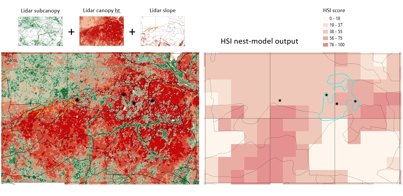
Improvement in forest-structure resolution using LiDAR-derived measurements (left) of sub-canopy structure, canopy height, and slope versus contemporary coarse-scale mapping of Goshawk habitat quality using forest-stand polygons and other broad-scale, lower-resolution data.
